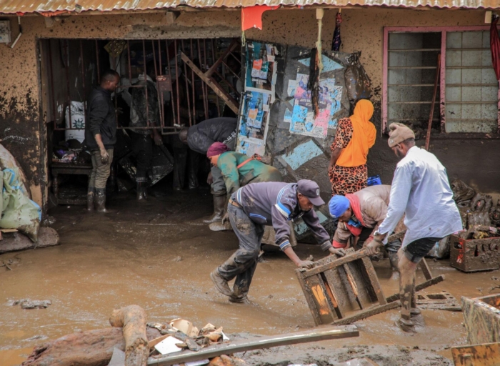
Severe flooding triggered by heavy rainfall has left ten people dead in Nairobi, with widespread disruption reported across major roads, residential areas, and transport corridors in the city. Authorities warn that the death toll could rise as search and rescue operations continue in several affected locations.
Victims Swept Away and Electrocution Incidents
According to Nairobi Police Commander George Seda, eight victims were swept away by rapidly rising floodwaters, with some trapped inside vehicles that were carried off by powerful currents. Two additional deaths were reported in separate electrocution incidents linked to the flooding.
Police also confirmed that at least 71 vehicles were stranded or trapped after key roads became impassable due to the heavy downpour.
Widespread Flooding Across the City
Residents woke up Saturday morning to flooded neighbourhoods, stranded motorists, and severe transport disruptions across the capital. The Secretary General of Kenya Red Cross Society, Ahmed Idris, said the flooding severely affected multiple residential estates and informal settlements, particularly in low-lying areas and river corridors.
Among the hardest-hit neighbourhoods were Pipeline and Embakasi, where sections of Kware Road were cut off. Other affected areas included Mukuru Kwa Njenga, Reuben, Viwandani, Kibra, Mathare, Huruma, Baba Dogo, and Bosnia.
Flooding also impacted South B, South C, Nairobi West, Lang’ata, Umoja 3, Chokaa, Njiru, Ruai, and Utawala. In northern and western Nairobi, rising waters were reported in Roysambu along Kamiti Road, Kahawa West, Githurai, Loresho, and parts of Westlands.
Major Roads and Highways Disrupted
Transport across the city was heavily affected overnight as floodwaters submerged several major highways and feeder roads. The Kenya Red Cross Society reported prolonged traffic gridlock as motorists struggled to navigate flooded routes.
Some of the most affected roads included:
- Central business district routes around Museum Hill and Uhuru Highway
- Mbagathi Way
- Mombasa Road near South C, Bellevue, and the Jomo Kenyatta International Airport exit
- Thika Superhighway around Githurai, Kahawa Sukari, and Kenyatta Road
- Lunga Lunga Road near the Kenya Power and Lighting Company depot
- Limuru Road near the Belgian Embassy
- Jogoo Road, Enterprise Road, Lang’ata Road near T-Mall, Riverside Drive, and Kawangware
Emergency Response and Rescue Efforts
Emergency teams were deployed overnight to assist affected residents. First responders from the Kenya Red Cross Society rescued at least 20 people stranded along Kirinyaga Road, safely evacuating them from flooded areas.
A military Rapid Response Unit also conducted traffic control operations and helped tow stalled vehicles at the Kariokor–Ring Road roundabout after the swollen Nairobi River blocked traffic. Additional traffic management operations were set up at Mbagathi Roundabout.
Government Response and Weather Warning
The Kenya Meteorological Department has warned that intense rainfall is expected to continue across much of the country, increasing the risk of further flooding, swollen rivers, and transport disruptions.
In response, Geoffrey Ruku announced that an emergency coordination meeting will bring together key disaster response agencies including the National Police Service, the National Youth Service, St. John Ambulance Kenya, the National Disaster Management Unit, and the National Disaster Operations Centre.
Authorities say the meeting will focus on strengthening emergency coordination and accelerating response efforts as Kenya braces for continued rainfall and possible flooding.